欢迎访问铁路通信信号工程技术,今天是 English

铁路通信信号工程技术 ›› 2021, Vol. 18 ›› Issue (2): 22-26.DOI: 10.3969/j.issn.1673-4440.2021.02.005

• • 上一篇    下一篇

电子地图轨道地理坐标描述方法研究

陈志强1,2,鲍鹏宇1,2   

  1. 1.北京全路通信信号研究设计院集团有限公司,北京 100070;
    2.北京市高速铁路运行控制系统工程技术研究中心,北京 100070
  • 收稿日期:2020-06-28 修回日期:2020-12-02 出版日期:2021-02-25 发布日期:2021-08-17
  • 基金资助:
    中国铁路总公司科技研究开发计划系统性重大项目(P2018G008)

Research on Method of Describing Track with Geographical Coordinates on Electronic Map

Chen Zhiqiang1, 2,  Bao Pengyu1, 2   

  1. 1. CRSC Research & Design Institute Group Co., Ltd, Beijing 100070, China;
    2. Beijing Engineering Technology Research Center of Operation Control Systems for High Speed Railways, Beijing 100070, China
  • Received:2020-06-28 Revised:2020-12-02 Online:2021-02-25 Published:2021-08-17

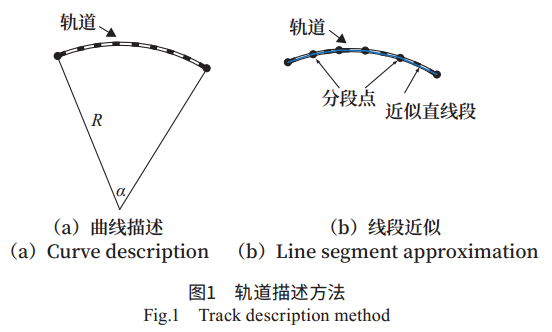
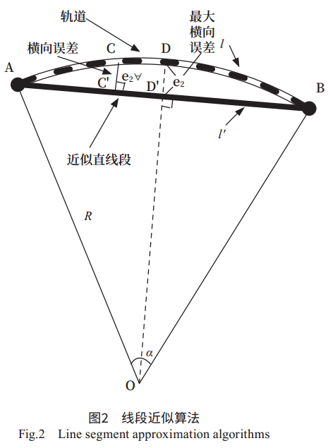
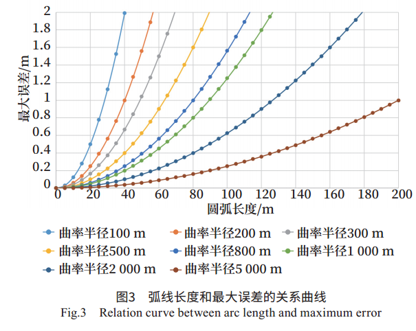
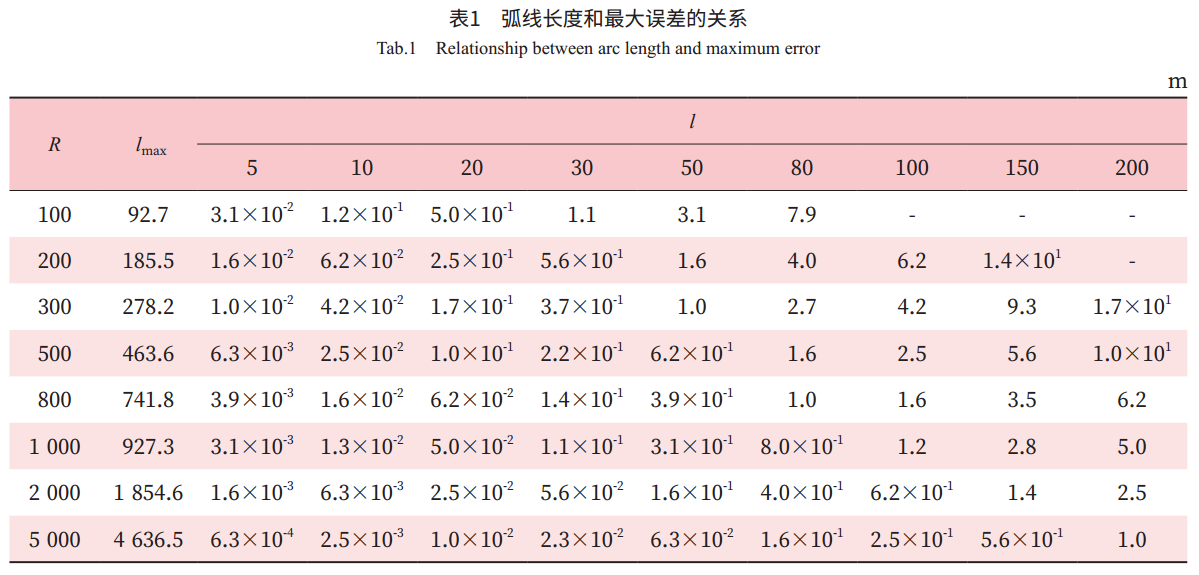
摘要: 卫星定位在列控系统中应用时,需要使用能够描述轨道地理坐标信息的电子地图文件。首先对弯轨的两种描述方法进行优缺点分析,提出线段近似法更有利于工程应用和实施,然后对使用线段近似点进行弯轨近似描述的误差进行量化分析,提出基于最大误差的近似点间隔确定方法,该方法既可以保证轨道描述精度又能有效降低电子地图数据量。

关键词: 列控系统, 北斗卫星导航系统, 电子地图, 卫星定位, 经纬度

Abstract: When satellite positioning is applied in the train control system, it is necessary to use electronic map files that can describe the geographic coordinate information of track. In this paper, two methods of describing curved rail are discussed and the advantages and disadvantages are analyzed, and the line segment approximation method is proposed to be more beneficial to engineering application and implementation. Then the error of curved rail approximate description using line segment approximate points is analyzed quantitatively, and the method of determination of approximate point interval based on the maximum error is proposed. This method can not only ensure the accuracy of track description but also effectively reduce the data amount of electronic map.

Key words: train control system, Beidou Navigation Satellite System (BDS), electronic map, satellite positioning, longitude and latitude

中图分类号: